

Key Takeaways
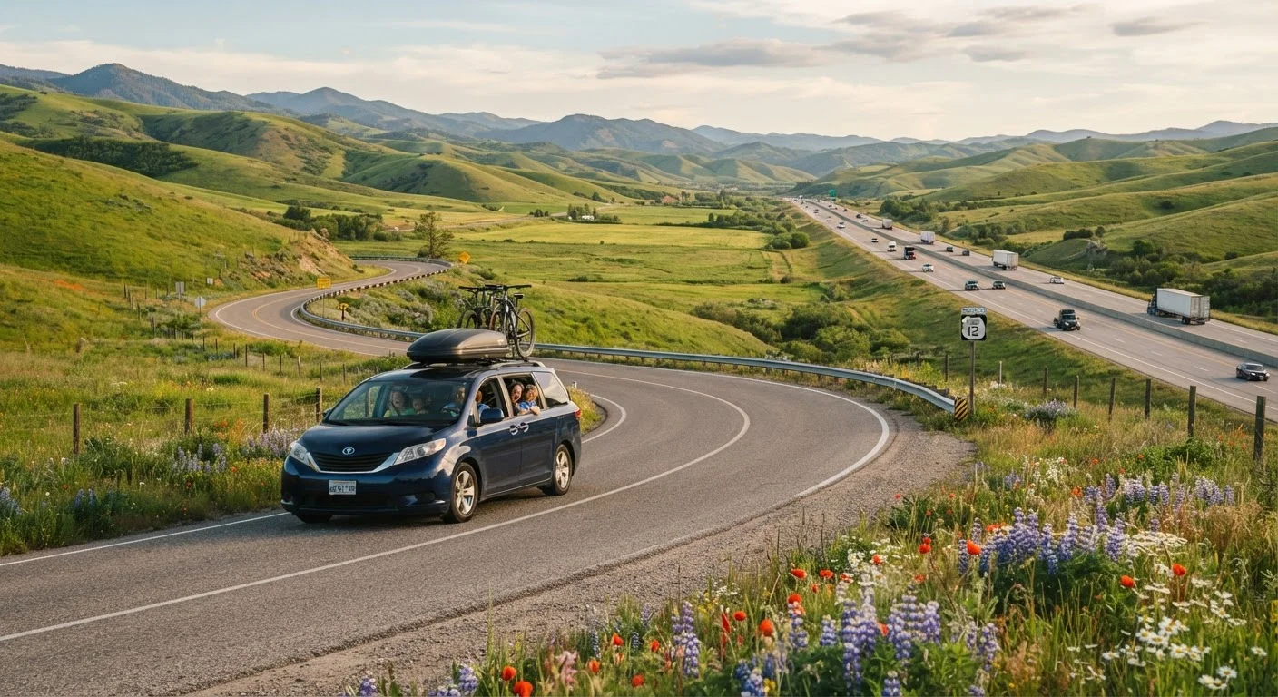
- Scenic byways add hours to drive time but can replace paid attractions with free roadside stops.
- Interstates reduce fuel costs on flatter terrain and offer predictable service station spacing.
- Spontaneity is easier on byways, but that flexibility can strain younger kids and rigid budgets.
- A split-route strategy, interstate for long hauls, byway for one memorable stretch, often works well.
- Food and lodging options thin out noticeably on scenic routes, which requires advance planning.
Option A
Scenic byways
The slower, more immersive road through America's landscapes.
Best for: Families who want the drive itself to be part of the vacation and have flexible schedules.
Option B
Interstate highways
The efficient, predictable backbone of American road travel.
Best for: Families with tight timelines, young children prone to restlessness, or fixed overnight reservations.
If you have school-age kids and two to three flexible days
Scenic byways
Older children engage well with roadside geology, small-town diners, and unplanned stops. The extra time pays off in memories without a large added cost.
If you have toddlers or infants on board
Interstate highways
Predictable rest-stop spacing every 30 to 50 miles and consistent food options make managing nap schedules and diaper changes far less stressful.
If your trip budget is very tight
Interstate highways
Steadier speeds mean more predictable fuel consumption, and competition among highway-adjacent gas stations and fast-food outlets can keep per-mile costs down.
If the journey is the destination and you want to minimize attraction spending
Scenic byways
National forest pull-offs, historic markers, and state park day-use areas along many byways cost little or nothing, replacing paid entertainment on the road.
If you're covering more than 500 miles in a single day
Interstate highways
No route type erases driver fatigue, but interstates cover ground faster and reduce total hours behind the wheel on very long travel days.
What each route type actually means
The term 'scenic byway' covers any designated road, state or federally recognized, chosen for its natural, cultural, or historic character. America's Byways program, run by the Federal Highway Administration, designates routes ranging from the Blue Ridge Parkway to the Pacific Coast Highway. State programs add hundreds more. These roads are almost always two-lane, lower speed limit, and routed through towns, parks, and landscapes that interstates deliberately bypass.
Interstate highways are engineered for throughput: wide lanes, controlled access, grade-separated interchanges, and speed limits typically between 65 and 80 mph depending on the state. They connect metropolitan areas efficiently and carry the bulk of long-distance American road travel. For a family, each type creates a genuinely different trip experience, and neither is wrong. The real question is which tradeoffs your family can absorb.
Our complete road trip planning guide covers how route choice fits into the broader puzzle of budgets, packing, and pit stops.
Time, fuel, and money compared
Time is the sharpest tradeoff. A 300-mile stretch that takes roughly four and a half hours on an interstate can stretch to seven or more hours on a byway with 45 mph speed limits, traffic through small towns, and the stops that make the route worth taking. For families with hotel reservations or a park permit with a check-in window, that gap matters.
Fuel math is more nuanced. Stop-and-go driving through towns and steep mountain grades on scenic routes can reduce fuel economy by 10 to 20 percent compared with steady 65 mph interstate cruising, according to U.S. Department of Energy fuel economy data. However, byway stops at free overlooks or state parks can offset money spent on paid attractions that highway travelers might reach faster but still pay to enter.
| Criterion | Scenic byways | Interstate highways |
|---|---|---|
| Typical speed limit | 35 to 55 mph | 65 to 80 mph |
| Drive time for same distance | 30 to 60% longer | Baseline |
| Fuel economy | Lower due to grades and stops | Higher at steady speeds |
| Rest stop frequency | Irregular, sometimes 60+ miles apart | Every 30 to 50 miles typically |
| Food and gas access | Limited, plan ahead | Consistent, competitive pricing |
| Roadside attractions | Many, often free | Few between exits |
| Kid engagement (older children) | High | Low to moderate |
| Kid engagement (toddlers/infants) | Low, facilities scarce | Higher, predictable stops |
| Spontaneity | High | Low |
Understanding where your road trip dollars actually go can help you decide whether saved time or saved attraction fees matter more for your specific budget.
Kid-friendliness and spontaneity
Children respond differently to each environment. On interstates, rest areas appear at regular intervals, bathrooms are generally clean and accessible, and the monotony of mile markers can actually help younger kids sleep. The predictability works in a parent's favor when managing snacks, naps, and short attention spans. Strategies for keeping kids engaged across long drives apply to both route types but become more important on interstates where the scenery changes slowly.
Scenic byways hand the landscape more personality, which older children and teenagers often find genuinely interesting. Roadside geological features, covered bridges, wildlife pullouts, and quirky small-town stops generate real conversation and break the trip into distinct chapters. The catch is that facilities thin out sharply. Some byway stretches run 60 or 80 miles without a gas station, and the ones that exist may not carry the snacks or formula a family needs. Planning food and fuel stops in advance is not optional on longer byway segments.
Checking byway conditions before you go
The Federal Highway Administration maintains a directory of all nationally designated byways at fhwa.dot.gov, and most state DOT websites list seasonal closures and road conditions for state-designated scenic routes. Mountain and desert byways can close with little notice due to weather or fire. Confirming conditions 24 to 48 hours before your planned departure reduces the chance of an unexpected detour.
How to combine both for a practical road trip
Most families do not have to choose exclusively. A common pattern is using the interstate to cover the bulk of the miles quickly, then peeling off onto a designated byway for one or two hours to see something genuinely different before returning to the highway. This keeps total drive time manageable while building the kind of moment families actually remember.
When planning a split route, identify the byway segment first, then work interstate legs around it. Check the byway's official state or federal page for current road conditions, seasonal closures, and facility locations before departing. Mountain byways in particular can close unexpectedly due to weather, and many are not suitable for large trailers or vehicles over a certain height.
For families thinking about broader trip structure, comparing camping and motel stays adds another layer to how scenic routes fit your budget: campgrounds are far more common along byways than near interstate corridors, which can change overnight costs significantly.
This article provides general travel planning information. Road conditions, facility availability, and costs change frequently. Always verify current conditions with state DOT and official byway sources before travel.